history_edu
Article
Article

New Citizen Science Project to Monitor Coastal Resilience at Tyrella Beach

A new community-led monitoring programme at Tyrella Beach is using drones and public photography to safeguard Northern Ireland’s sand dune systems.

Katherine Kelly, Communications & Advisory

Katherine Kelly
Communications & Advisory

Posted

11th Jul, 2026

Length

2 minute read

Type

News

Share

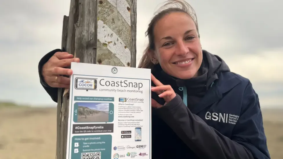
  • Dr. Melanie Biausque introduces the new citizen science initiative at Tyrella Beach
    Dr. Melanie Biausque introduces the new citizen science initiative at Tyrella Beach

Tyrella Beach in County Down is a 2 km sandy beach backed by 25 hectares of mature sand dunes within an Area of Special Scientific Interest (ASSI). 

While the site holds both Blue Flag and Green Coast awards, a 2018 assessment by the Department of Agriculture, Environment and Rural Affairs (DAERA) identified the dune system as being in an “unfavourable condition.”

In response, restoration measures including fencing, grazing management, and marram grass planting have been implemented to stabilise the dunes. 

However, until now, there has been no structured programme to track the geomorphological effectiveness of these interventions.

Led by Dr. Melanie Biausque of the Geological Survey of Northern Ireland, the CO-creating COastal Resilience (COCOR) project establishes a rigorous scientific monitoring framework. 

The programme includes:

  • Monthly topographic surveys using RTK-DGPS to detect seasonal variability.
  • High-resolution drone mapping to track sediment dynamics and dune evolution.
  • Comparison with baseline datasets, such as the 2021 LiDAR data, to quantify long-term morphological changes.

A central component of the project is the use of CoastSnap, a global citizen science initiative.

Beach visitors are encouraged to participate by taking standardised photographs of the shoreline from a fixed viewpoint using their smartphones.
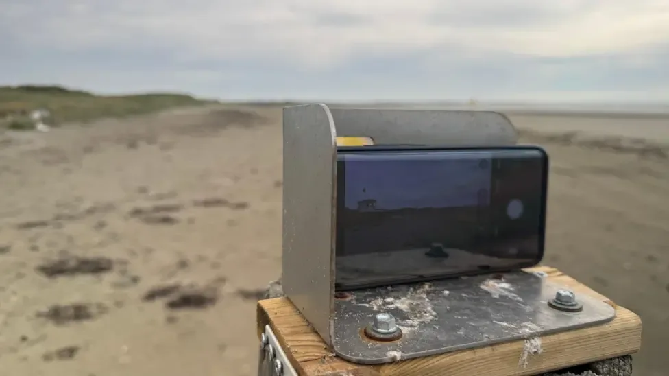

  • CoastSnap cradle on Tyrella beach
    CoastSnap cradle on Tyrella beach

While these photos may look like simple snapshots, the project uses a specialised technique called photogrammetry to turn community images into valuable scientific data.

This technology allows researchers to pinpoint the position of the coastline with an accuracy similar to that of professional survey teams.

Volunteers will also contribute field measurements of vegetation lines and dune movement using existing fencing poles as reference markers.

By capturing images from the same location over months and years, participants will help create a valuable visual record of coastal change, complementing the scientific survey data.

By integrating professional research with community observation, the project aims to foster long-term coastal stewardship.

"Sand dunes are natural defences that protect our coasts while supporting rich ecosystems," says Dr. Melanie Biausque. " By involving local communities, we hope to strengthen connections with this landscape and help ensure this unique coastal environment is preserved for future generations."

The COCOR project is part of the Coast-R Network and is supported by several local partners and funders.

Community outreach and school events are planned throughout the year to provide hands-on demonstrations of these monitoring techniques.

Generously supported by:
keyboard_arrow_up